CooperativeCooperation status · 4 of 5

AQUIFER · S021 South America · beneath four countries

The Guaraní

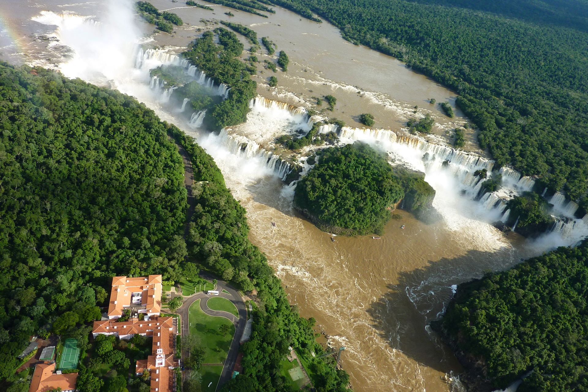
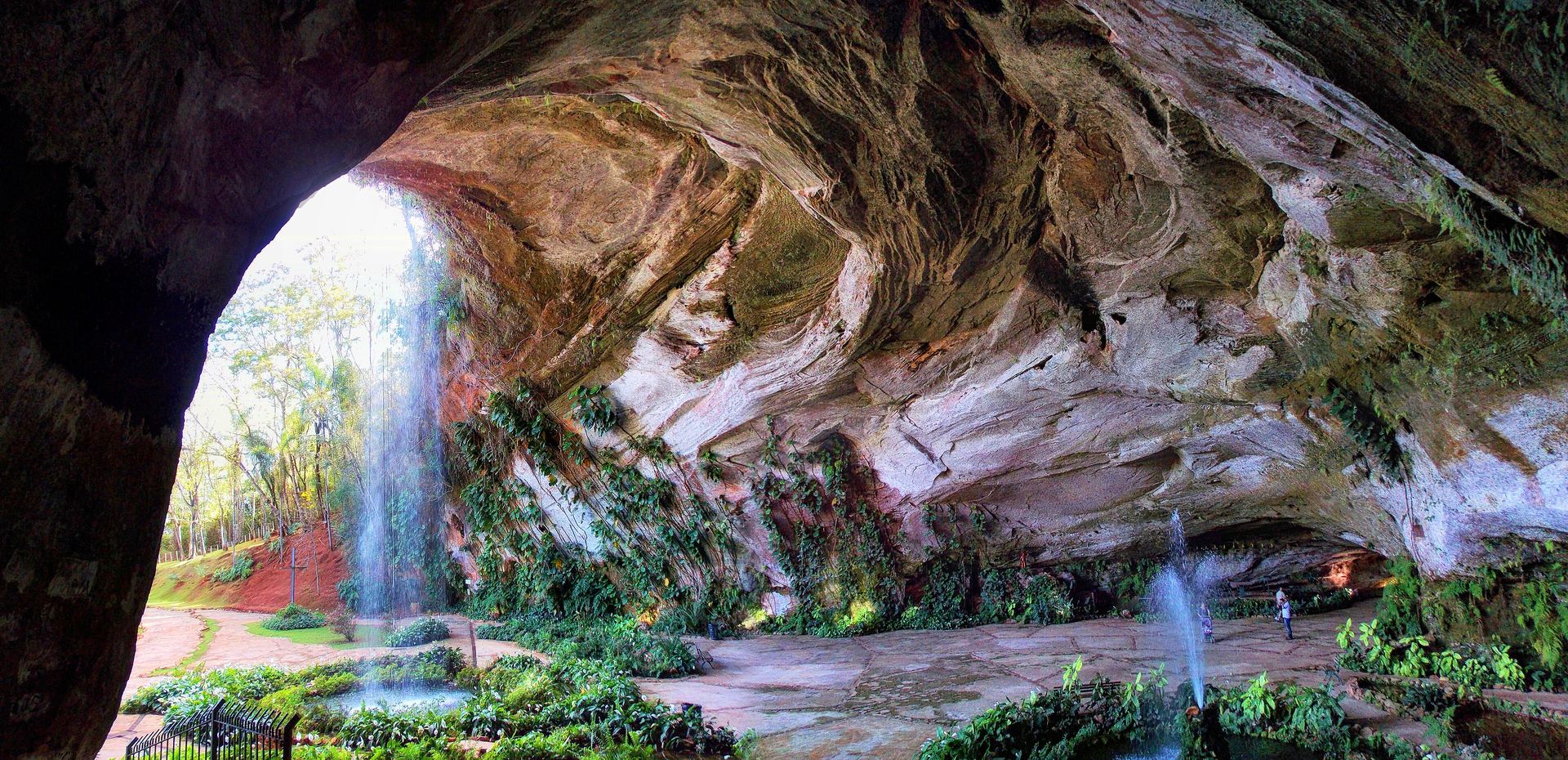
You are looking at the only part of this story you can see: water falling over the rock that holds a hidden sea. Everything else happens in darkness, up to 1,800 metres down.

▾ go underground

The invisible sea

There is a sea under South America. It has no shore and no horizon; no one has ever seen it, and no one ever will. It fills the pores of a sandstone laid down when dinosaurs walked a desert the size of a continent — and today it holds roughly enough fresh water to supply the entire world for decades. Above it live ninety million people in four countries, most of whom have never heard its name.

The Guaraní Aquifer System stretches under some 1.1 million square kilometres of Brazil, Argentina, Paraguay and Uruguay — an area larger than France and Spain combined. Cities drink it. Farms pump it. In Uruguay and Argentina, resorts pipe up its warmth as thermal baths. It crosses three international borders without a single visible sign that it exists.

Rivers announce themselves; aquifers keep their secrets. Sharing water you can see is hard. Sharing water no one can see is a different problem entirely.

Legends & names

A sea named after a people.

Acuífero GuaraníSpanish
Aquífero GuaraniPortuguese
Botucatuthe rock · Brazil
Tacuarembóthe rock · Uruguay · Paraguay
Misionesthe rock · Argentina

Until 1996 the water had no single name — each country named the sandstone it sat in, as if four rooms refused to admit they shared a house. The Uruguayan geologist Danilo Antón proposed naming the whole system for the Guaraní people, whose lands span all four countries and in whose language y — a single letter — means water. The name was an argument: one people, one aquifer, one responsibility.

The aquifer

The real shape of the hidden sea.

Sources: GRACE / GRACE-FO gravimetry & published La Plata studies (storage); WRI Aqueduct (stress); FAO AQUASTAT (dependency). Real aquifer & country geometry (IGRAC 2025 · Natural Earth); figures curated from published data.

The Gruta dos Palhares sandstone cave in Brazil — the Botucatu formation that holds the Guaraní aquifer
The rock that holds the sea: Botucatu sandstone, laid down as desert dunes more than 130 million years ago, here exposed at Gruta dos Palhares, Brazil. Photo: Fabianni Luiz Ribeiro · CC BY-SA 3.0 · Wikimedia Commons
0countries above itArgentina, Brazil, Paraguay, Uruguay
0km² in extentlarger than France and Spain combined
0km³ of fresh waterestimated storage — decades of global supply
0million people above itfrom São Paulo state to the Argentine littoral

Cooperation & conflict

How do you negotiate over something no one can see?

For most of history, the answer was: you don't. Groundwater was pumped by whoever drilled first and asked no questions. Of the 882 international water treaties signed since 1820, only a few dozen substantively address groundwater at all. The Guaraní's story is the great exception — a treaty negotiated not after a crisis, but before one.

1996

The sea gets a name

Danilo Antón proposes "Guaraní Aquifer System" for the sandstone waters of all four countries — the first act of shared ownership is an act of naming.

2003–2009

Four countries map one aquifer

The GEF/World Bank Guaraní Aquifer System Project: a joint scientific campaign in which the four states drill, measure and model the aquifer as a single body — building the trust the treaty would need.

2010

The Guaraní Aquifer Agreement

Signed at San Juan, Argentina: one of the first treaties on Earth dedicated to a specific transboundary aquifer. Each state is sovereign over its territory — and each accepts the duty not to cause the others significant harm.

2017

Cooperation goes local

Concordia (Argentina) and Salto (Uruguay), facing each other across the Uruguay River, agree to manage their shared thermal groundwater together — treaty principles at the scale of two towns.

2020

Entry into force

A decade after signature, the fourth ratification arrives and the agreement becomes binding law — the slow tempo of groundwater, mirrored in its diplomacy.

The cooperation indicator

How is the sharing going?

High tensionTensionMixedCooperativeStrong cooperation

01 · Event history

Quiet — and cooperative

The record is thin, as it is for almost all aquifers: no water wars, no sanctions — joint science and negotiation dominate what record exists.

TFDD events: none — the events database covers rivers, not aquifers. Absence of a record is not absence of stakes.

02 · Institutional depth

Rare — a dedicated treaty

Two agreements in the record — but one is a dedicated aquifer treaty, which fewer than a handful of the world's 426 shared aquifers possess. The promised joint commission, however, is still not operational.

Dedicated treaties: 2

03 · Operational arrangements

Reported, not yet running

All four countries report the Guaraní under SDG 6.5.2, and IGRAC rates its boundary data "Good" — but an operational arrangement in daily practice is still being built.

SDG 6.5.2: weighted 55.4% — and all 4 states reported, itself unusual for an aquifer

△ · Conflict-risk forecast

Low — outside coverage

Not part of the cooperation score. The Water, Peace & Security partnership forecasts near-term conflict risk from climate, hydrological and socio-economic signals — a forward-looking companion to the historical record below.

Water, Peace & Security forecast → · a forecast, not scored here

The institution

The commission that does not yet meet

The 2010 Guaraní Aquifer Agreement promised a joint commission (Article 15) to coordinate the aquifer’s management. Fifteen years on, it has never convened — the institution exists on paper only.

More: all 117 river basin organizations →

The shadow record · water conflict

26events, 1900–2025
8 casualties2 weapons21 triggers22 since 2000

Pacific Institute typology — trigger: a dispute over water that sparks violence · weapon: water or water systems used as a means of attack · casualty: water systems damaged in fighting.

Water-conflict events recorded across the Guaraní's four countries (Pacific Institute) — national and local incidents. The aquifer itself has never been the object of violence — a quiet the treaty aims to keep.

A four-out-of-five for an aquifer is extraordinary — most of the world's 426 shared aquifers would score a grey "no assessment possible." The honest caveat runs the other way here: the treaty exists, but its joint commission does not yet meet. Paper cooperation is real cooperation only when someone convenes the meeting. How this indicator is built →

The paper aquifer

Two agreements — and that is what makes it exceptional.

2010

Guaraní Aquifer Agreement

Signed by Argentina, Brazil, Paraguay and Uruguay at San Juan. Sovereignty over each territory, a duty to avoid significant harm to the neighbours, information exchange, and a commission to come. In force since 2020.

Signed San Juan · groundwater · 4 parties · in force 2020
2017

Concordia–Salto Understanding

Across the Uruguay River, an Argentine municipality and a Uruguayan intendencia agree to jointly steward the thermal waters both economies depend on — the aquifer treaty's principles, applied at the scale of two towns.

Municipal accord · thermal groundwater · 2 parties
?

The missing commission

Article 15 of the agreement promises a joint commission to coordinate the aquifer's management. Fifteen years after signature, it has yet to convene — the Guaraní's next chapter is an empty chair.

Pending · the atlas keeps data gaps visible

For comparison: the Danube has 62 agreements. Underground, two is world-leading. SOURCE: TFDD INTERNATIONAL FRESHWATER TREATIES DATABASE

What the research says

Why should one agreement over one aquifer matter to the other 425? The legal scholarship offers an answer — and a caution:

The Guaraní Agreement's significance lies less in what it enforces than in what it demonstrates: that four states can write binding international law for a resource none of them can see, and can do so before a crisis forces them to. Signed in 2010, it was the first treaty for a specific transboundary aquifer concluded after the UN International Law Commission's Draft Articles on the Law of Transboundary Aquifers.

The caution is in the years that followed. Ratification was slow, and the institutional machinery the agreement sketched has been slower still — which is why the legal literature has moved from describing the Guaraní as a beacon to treating it as an open question. A treaty proves that agreement is possible; it does not, on its own, prove that governance follows.

Francesco Sindico Professor of International Environmental Law, University of Strathclyde Summarised from: Sindico, F. (2011) “The Guarani Aquifer System and the International Law of Transboundary Aquifers”, International Community Law Review 13(3): 255–272; and Sindico, Hirata & Manganelli (2018), Journal of Hydrology: Regional Studies · read the original →

Our summary of published work — not a quotation
The view from above

In Concordia and Salto, the aquifer is not an abstraction — it is hot water, tourism, and a payroll:

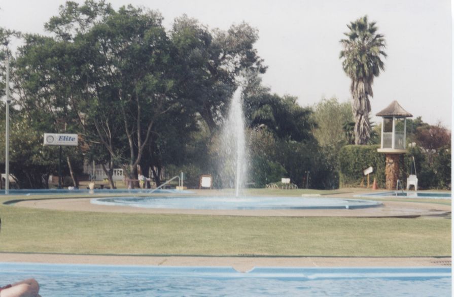
The thermal pools at Termas de Daymán, Salto, Uruguay
The thermal water comes up at forty degrees, and the tourists come with it. People here understood before the diplomats did: if Salto pumps too hard, our wells feel it — and theirs feel ours. The border is on the map, not in the rock.

A thermal-well operator's accountComposite voice — drawn from published reporting on the Concordia–Salto thermal corridor and GEF project consultations · Illustrative photo: Termas de Daymán, Góngora, CC BY 2.5

Composite, clearly marked — not a named individual
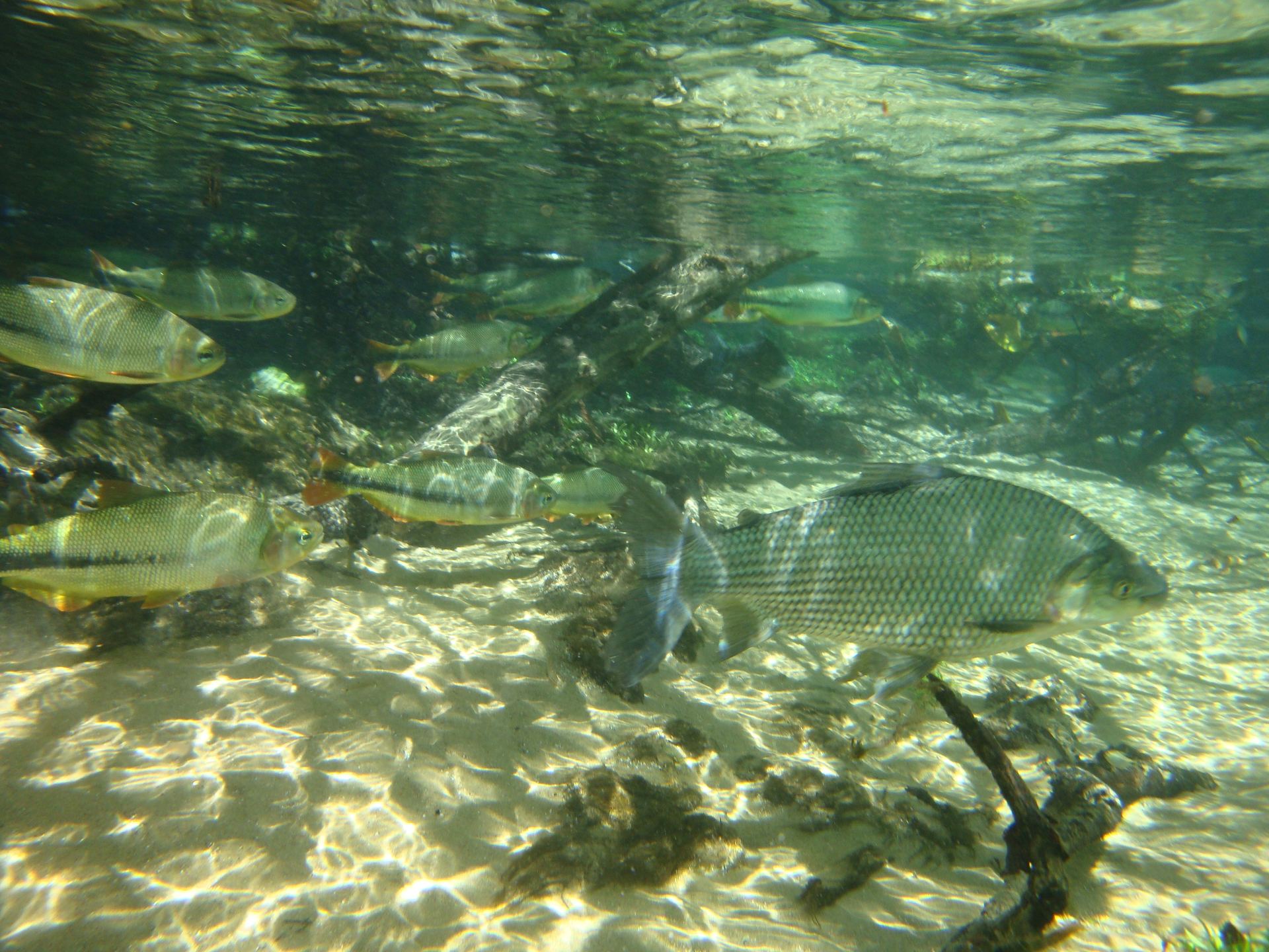
Crystal-clear spring water rising through white sand in the Guaraní recharge region
Where the hidden sea touches daylight: a crystalline spring in the recharge country — rain that will spend centuries underground begins its journey here. Photo: Daniel Francisco Madrigal Möller · CC BY-SA 3.0 · Wikimedia Commons

Prospects

The slowest water, the longest consequences.

Water in the Guaraní moves metres per year. Rain that soaks into the recharge zones today may not reach a deep well for centuries — which means every mistake is inherited by people not yet born. The pressures are already visible at the surface: expanding irrigation and cities drawing down local water tables, and agrochemicals seeping into the thin, sandy recharge zones that are the aquifer's only lungs.

The treaty exists; the science is good; the commission is missing. The Guaraní's question for the century is whether institutions can learn to move as slowly and as surely as the water they govern — to act on problems whose symptoms will not appear for generations.

Above ground, water diplomacy answers crises. Underground, it has to answer the future.

Aerial view of Iguazú Falls on the border of Brazil and Argentina
Iguazú, where surface water makes the spectacle — directly above the sandstone country of the hidden sea. The two systems, seen and unseen, share the same rain. Photo: chensiyuan · CC BY-SA 4.0 · Wikimedia Commons

Next story · River basin

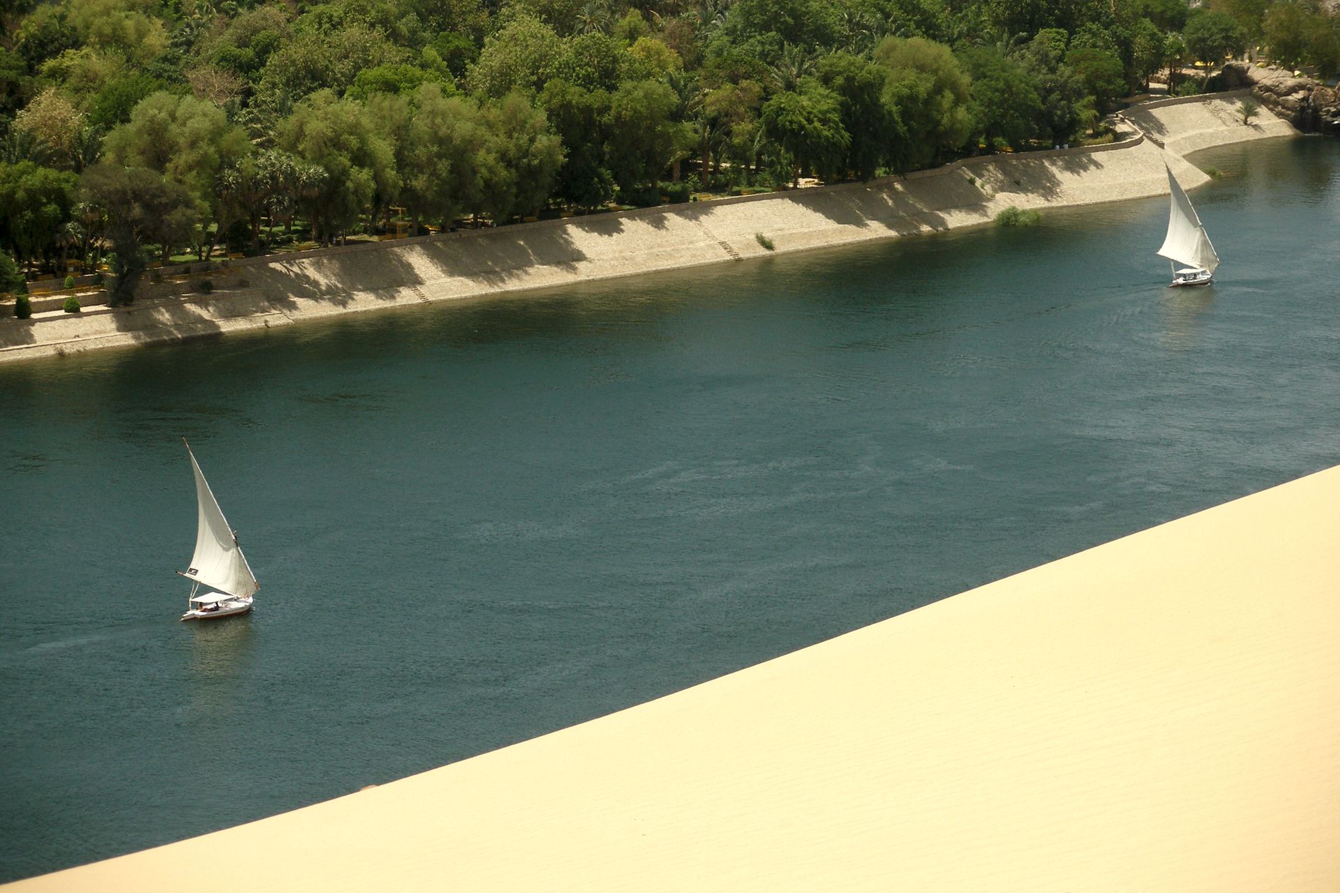
The Nile

Eleven countries, five thousand years of recorded history, and a dam that redrew the politics of a continent. Back to the surface — where the water, and the tension, are visible.

Read the story →