Strong cooperationCooperation status · 5 of 5

RIVER BASIN · DANU Europe · Black Forest → Black Sea

The Danube

Nineteen countries. Four capitals. Twenty-eight hundred kilometres. No river on Earth is shared by more nations — and none has produced more water diplomacy.

▾ begin

The river of nations

It begins as a trickle in a German courtyard. In the town of Donaueschingen, at the edge of the Black Forest, a spring bubbles into an ornamental basin — and from this modest pool, a river sets out on the most international journey any water makes. By the time the Danube empties into the Black Sea, it will have touched the lives of nineteen countries and some eighty million people.

No other river basin on the planet is shared by so many nations. The Amazon carries more water, the Nile more history-book fame — but the Danube carries more borders. It flows through or past four capital cities — Vienna, Bratislava, Budapest, Belgrade — collecting the waters of the Alps, the Carpathians and the Balkans as it goes.

"Whoever controls the Danube," an old imperial saying went, "holds the key to Europe." Today, nobody controls it — nineteen countries manage it together.
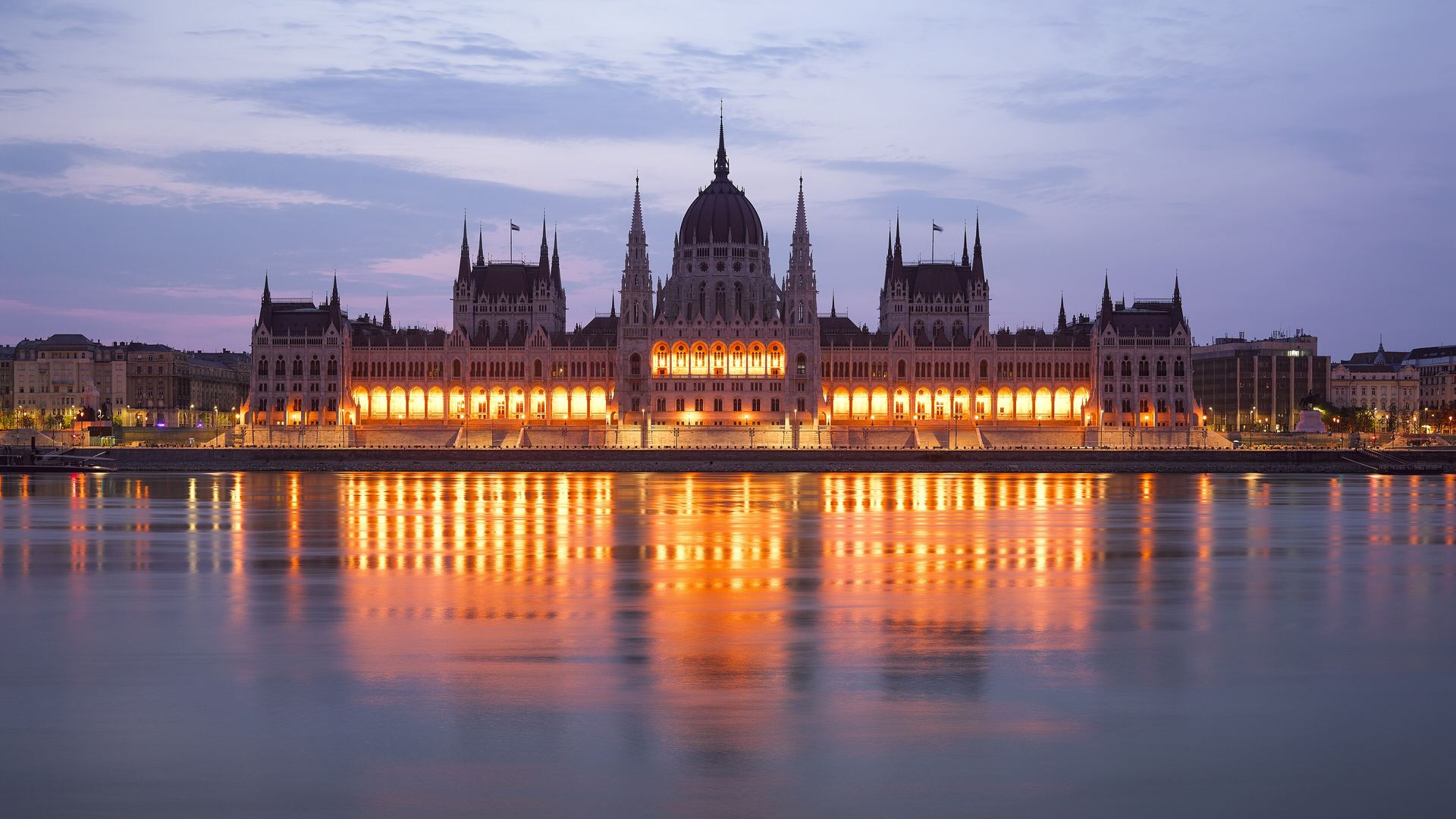
The Danube flowing past the Hungarian Parliament in Budapest at dusk
Budapest — one of four capitals strung along a single river like beads on a thread. Photo: Godot13 · CC BY-SA 4.0 · Wikimedia Commons

Legends & names

One river, ten tongues.

DonauGerman
DunajSlovak
DunaHungarian
DunavCroatian · Serbian · Bulgarian
DunăreaRomanian
ДунайUkrainian

The ancient Greeks called it the Ister and placed it at the edge of the known world. The Romans made it the frontier of an empire. Strauss set it to a waltz — famously blue, though rivermen will tell you it is anything but. Every name is a claim; the river answers to all of them and belongs to none.

The basin

From a courtyard spring to a delta the size of a country.

Sources: FAO AQUASTAT (external-water dependency); WRI Aqueduct (baseline water stress); GOODD / public records (dams). Real basin & country geometry (TFDD · Natural Earth); figures curated from published data.

0riparian countriesfrom Germany to Ukraine — more than any other basin on Earth
0km² of basinone tenth of the European continent
0km from source to seaEurope's second-longest river, after the Volga
0million peopledrink, farm, ship and fish on its waters

Cooperation & conflict

Two centuries of learning to share.

The Danube has seen empires rise and dissolve along its banks — Habsburg, Ottoman, Soviet. Each collapse multiplied the number of flags along the river; each multiplication forced a new round of diplomacy. The result is the densest treaty record of any river basin in the world: 62 agreements in the TFDD database, the oldest signed in 1858.

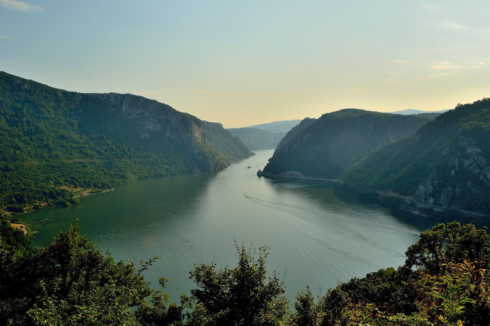
The Iron Gates gorge, where the Danube cuts between Serbia and Romania
The Iron Gates, where the river saws through the Carpathians. The dams built here jointly by Yugoslavia and Romania in 1972 remain one of Europe's largest acts of shared engineering. Photo: Geologicharka · CC BY-SA 4.0 · Wikimedia Commons
1856

The European Commission of the Danube

Born from the Treaty of Paris after the Crimean War — one of the world's first international river organizations, created to keep the river open to the ships of all nations.

1858

The oldest Danube-basin agreement in the treaty record

Austria and Bavaria agree on the Inn, the Danube's mightiest Alpine tributary — the earliest of 62 basin agreements in the TFDD database.

1948

The Belgrade Convention

In a divided post-war Europe, the riparian states re-found the navigation regime: free shipping for all, management by the riverside countries themselves.

1972

The Iron Gates

Yugoslavia and Romania jointly dam the great gorge — cooperation in concrete, though at a heavy cost to migrating sturgeon and drowned villages.

1994

The Danube River Protection Convention

Signed in Sofia as the Iron Curtain lifts: the basin's environmental constitution, committing the countries to protect and sustainably use the whole river system.

1998 →

The ICPDR era

The International Commission for the Protection of the Danube River begins work — today coordinating 14 countries plus the EU on one shared basin management plan, with the Sava countries adding their own framework agreement in 2002.

The cooperation indicator

How is the sharing going?

High tensionTensionMixedCooperativeStrong cooperation

01 · Event history

Overwhelmingly cooperative

State-to-state water interactions in the TFDD events record are dominated by joint projects, data sharing and agreements.

TFDD events 1948–2008: 975 recorded · mean intensity +1.84 on the BAR scale · 84% cooperative

02 · Institutional depth

Deepest in the world

Agreements since 1858, a standing basin commission (ICPDR), and a joint management plan covering the entire basin.

TFDD treaties: 62 · browse them →

03 · Operational arrangements

Near-complete coverage

Under SDG indicator 6.5.2, nearly the whole basin area is covered by operational cooperation arrangements.

SDG 6.5.2: basin-area-weighted 94.6% · 16 of 18 riparians reported

△ · Conflict-risk forecast

Low — but the delta is a war frontier

Not part of the cooperation score. The Water, Peace & Security partnership forecasts near-term conflict risk from climate, hydrological and socio-economic signals — a forward-looking companion to the historical record below.

Water, Peace & Security forecast → · a forecast, not scored here

ICPDR

The institution

International Commission for the Protection of the Danube River

Founded 1998 · 14 states plus the EU · the basin’s standing management body, running one joint plan from the Black Forest to the Black Sea.

www.icpdr.org ↗

More: all 117 river basin organizations →

The shadow record · water conflict

241events, 1900–2025
188 casualties49 weapons17 triggers202 since 2000

Pacific Institute typology — trigger: a dispute over water that sparks violence · weapon: water or water systems used as a means of attack · casualty: water systems damaged in fighting.

Water-conflict events recorded across the Danube's countries in the Pacific Institute Water Conflict Chronology — national and local incidents, not only transboundary disputes. The post-2022 spike reflects attacks on Ukrainian water and energy systems. Cooperation absorbs the disputes it can; it does not end them.

A five-out-of-five score does not mean a river without disputes — Hungary and Slovakia argued over the Gabčíkovo dam all the way to the International Court of Justice (see the ruling →). It means the disputes are settled with lawyers and commissions, not force. Cooperation and conflict coexist on every shared river; the Danube shows what it looks like when institutions absorb the conflict. How this indicator is built →

The paper river

Three agreements that made the modern Danube.

1948

Convention regarding the Regime of Navigation on the Danube

The "Belgrade Convention." Guarantees free navigation for vessels of all states and puts management of the waterway in riparian hands — still in force today.

Signed Belgrade · navigation · 7 original parties
1994

Convention on Cooperation for the Protection and Sustainable Use of the River Danube

The basin's environmental constitution, signed in Sofia. Established the ICPDR and the principle that the Danube is managed as one system, from Black Forest to Black Sea.

Signed Sofia · environment & water quality · 14 parties + EU
2002

Framework Agreement on the Sava River Basin

Four states that had recently been at war — Bosnia and Herzegovina, Croatia, Slovenia and FR Yugoslavia — created a joint commission for the Danube's largest tributary. Water as peacebuilding, in practice.

Signed Kranjska Gora · navigation, water management · 4 parties

…and 59 more agreements in the record, from Alpine border brooks to the delta. SOURCE: TFDD INTERNATIONAL FRESHWATER TREATIES DATABASE

What the research says

What does two centuries of Danube diplomacy actually teach the rest of the world? The comparative research on river basin organisations suggests this:

River basin organisations such as the ICPDR are easy to mistake for luxuries that peaceful regions can afford. The comparative evidence points the other way: the institution is part of what produces the peace. What matters is not that a commission exists but how it is built — whether it has its own secretariat and funding, whether it can monitor and verify, and whether it has a route for handling disputes short of rupture.

The Danube's real lesson is about time. Its machinery was assembled over decades, across regime changes and a war, and it is that accumulated institutional habit — not any single treaty — that lets the basin absorb disputes which would destabilise a younger arrangement.

Susanne Schmeier Professor of Water Law and Diplomacy, IHE Delft Summarised from: Schmeier, S. (2013) Governing International Watercourses: River Basin Organizations and the Sustainable Governance of Internationally Shared Rivers and Lakes, Routledge · read the original →

Our summary of published work — not a quotation

The view from the water

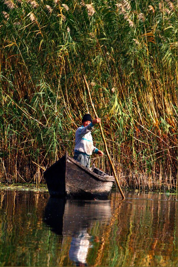
Diplomacy is signed in capitals; it is lived in the reeds. In the delta villages of Romania and Ukraine, fishing families have watched the treaties come and go:

A fisherman poling his boat through the reeds of the Danube Delta
My grandfather fished under one flag, my father under another, and I under a third. The sturgeon never asked for papers — and now that they are almost gone, no single country can bring them back alone.

A delta fisherman's accountComposite voice — drawn from published interviews in Danube Delta reporting (WWF, ICPDR public consultations) · Illustrative photo: Raff, CC BY 2.0

Composite, clearly marked — not a named individual
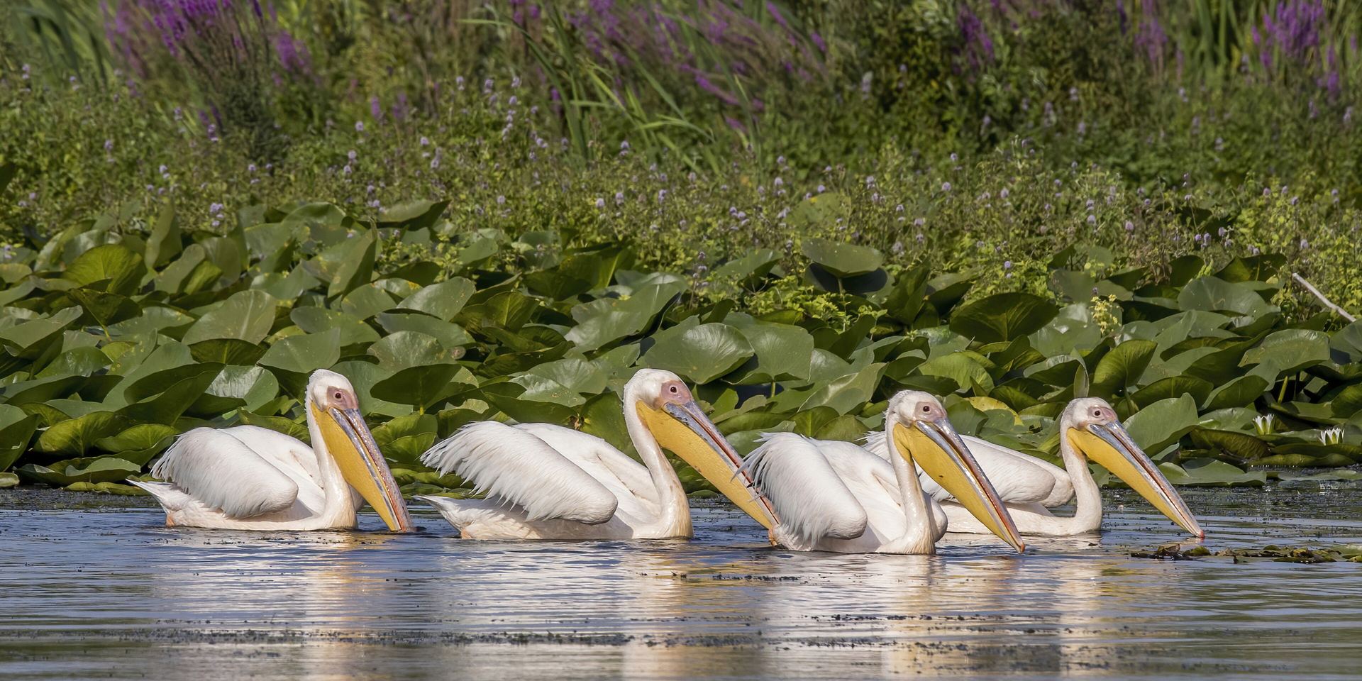
White pelicans taking off in the Danube Delta
White pelicans in the delta — Europe's largest wetland, shared to the very last kilometre. Photo: Charles J. Sharp · CC BY-SA 4.0 · Wikimedia Commons

Prospects

The next test is not political.

The Danube solved, better than almost any river on Earth, the problem of too many countries. Its next problem is different: climate. Alpine glaciers that feed the Inn are retreating; summer low-water now regularly halts shipping; the delta — a UNESCO wetland the size of a small country — is starved of the sediment the dams withhold.

The machinery built for sharing the river — the commissions, the joint plans, the habit of meeting — now has to learn to share a shrinking river. Nineteen countries taught the world how to divide a river's uses. Whether they can jointly adapt to a changing one is the Danube's next chapter — and everyone else's preview.

The Danube is no longer a frontier between empires. It is a rehearsal space for the century ahead.

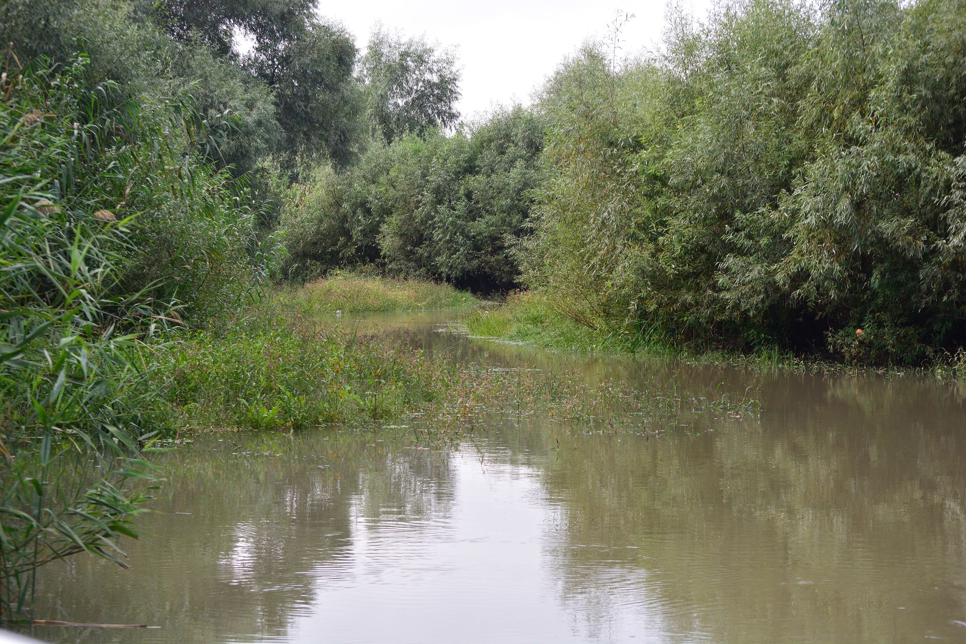
A quiet side channel in the Danube Delta
The delta: 5,800 km² of reeds, lakes and pelicans — and the river's final border crossing. Photo: Joe Mabel · CC BY-SA 4.0 · Wikimedia Commons

Next story · Aquifer

The Guaraní

Beneath Brazil, Argentina, Paraguay and Uruguay lies a hidden sea — enough water to supply the world for decades, and one of the only aquifers on Earth with its own treaty. Now, go underground.

Read the story →